From Tracking Mosquitoes to Trees With Disease, GIS Works
From tracking disease in Ponderosa pines to managing mosquitoes, Geographic Information Systems are doing more and more to help utilities, government and scientists in the Flathead Valley.
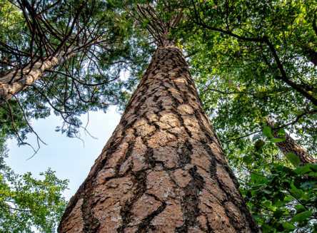
Flathead Electric Cooperative is using GIS to map vegetation along its powerlines, said Jake Harte, a data specialist with the Co-op during a talk last week that featured examples of how GIS is being used locally.
For the Co-op, the utility is concerned about trees near its powerlines, particularly during wildfire season. Harte noted the Camp Fire in 2018 in Paradise, California resulted in the bankruptcy of Pacific Gas and Electric, as downed powerlines were found to be the cause of the blaze.
So FEC, like dozens of utilities across the West, is taking proactive steps to manage trees and other evegation near its lines.
“That’s where GIS enters the picture,” Harte noted.
The utility uses photos taken by Landsat, a NASA satellite that’s been taking publicly available photos of the Earth since 1972, to map vegetation type and density near its powerlines.
The idea is to take a bird’s eye view of the landscape and map where the densest vegetation is near the lines and then ground truth the data for crews so they can take the appropriate measures, such as trimming trees near lines or removing them altogether if need be.
Researchers from the Flathead Lake Biological Station in concert with students from Flathead Valley Community College are also using GIS and satellite imagery to map trees, but for an entirely different reason.
In 2022 a hail storm struck the Bigfork area with golf-ball sized hail and 60 mph winds. Soon thereafter the needles on many Ponderosa pines began turning yellow in the Woods Bay area and into the Swan Valley.
The stress turned out to be too much for many trees as they were infected by a Diplodia shoot blight fungal infection, exacerbated by years of drought and other pests— western pine and “engraver” beetles.
As a beetle tries to burrow into a healthy Ponderosa, the tree produces resin. Eventually, after fighting a continuous ooze of resin, the beetle tires out and dies. When Ponderosa pines are impacted by drought conditions they may not have enough water to produce the resin needed to oust the beetles.
And the trees die.
Today, the effort to monitor Ponderosa pines has been expanding not just in Bigfork, but across the Flathead Valley. Like the utility, researchers are using satellite photos (though higher resolution ones then what’s available from Landsat) and citizen science to monitor trees.
On the ground, landowners and volunteers monitor trees and possible symptoms of disease through a phone app called Survey123. That ties in directly with satellite and GIS data to determine where the worst outbreaks are.
The best way to treat the disease is through prevention, such as thinning dense stands and making sure trees have enough water. It’s very difficult to spray trees for the beetles because many are more than 100 feet tall and the application has to cover the entire trees.
GIS in conjunction with the Survey123 app is also being used by Flathead County in its mosquito control efforts, noted Nathan Holm, GIS supervisor for the county.
The county has been using GIS to map mosquito-prone areas. It also uses the Survey123 app to complete on-the-ground activities, such as when and where to spray, how much and when the area was last sprayed. They can also track whether it’s private or public land and whether they have permission to spray there.
Holm and his team at the county GIS offices have been able to seamlessly integrate the Survey123 app with the county’s GIS system and with an Excel spreadsheet.
The end result is virtually real time dashboard where they can track the mosquito control effort. It’s also saved the county about $10,000 annually in running the program through the efficiencies found by using GIS.